Control, Savings, and Security
Having a geolocation system is not just an advantage but a necessity for any company that manages vehicle fleets. Lack of control over location, operating time, and driver behavior can lead to economic losses and unnecessary risks.
Implementing a geolocation system allows optimizing fleet management, translating each improvement into a short-term return on investment and a drastic reduction in operating costs.

Accuracy and Profitability with a Monitoring Center
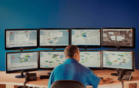
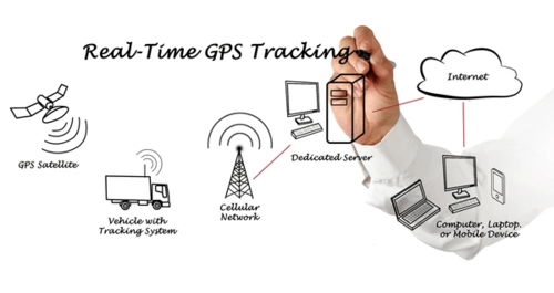
A well-implemented system maximizes operational efficiency. With a monitoring center equipped with advanced technology, it's possible to supervise every unit in real time, obtaining key data that transforms transportation management into a precise and strategic operation.
Our technology allows anticipating mechanical problems, scheduling preventive maintenance, and detecting driving habits that cause wear, thus optimizing your company's resources.

15 Key Benefits of Geolocation for Fleets
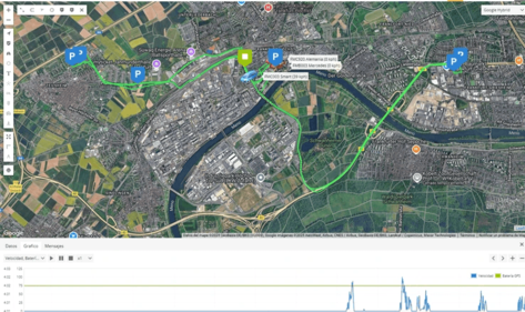
Real-time location
Know the exact position of each vehicle at all times.
Route optimization
Reduce travel times and improve delivery logistics.
Reduced downtime
Avoid unnecessary delays and improve productivity.
Fuel savings
Minimize consumption through more efficient routes.
Enhanced safety
Protect assets and drivers with real-time alerts.
Detailed reports
Analyze fleet performance with customized reports.
Preventive maintenance
Schedule check-ups based on actual vehicle usage.
Effective communication
Quick connectivity between drivers and managers.
Reduced environmental impact
Lower carbon footprint with optimized routes.
Traffic management
Avoid congestion and improve travel efficiency.
Theft protection
Immediate tracking in case of loss or theft.
Increased productivity
Maintain more efficient operational control.
Assisted navigation
Facilitate transit in complex areas with safe routes.
Strategic planning
Optimize deliveries and operations with accurate data.
Rapid emergency response
Reduce action times in critical incidents.


